
| MO State Facts |
|---|

|
| Territory: June 4, 1812 |
| Statehood: August 10, 1821 |
| Counties: 114 |
| Borders: TN, AR, IL, IA, KS, KY, NE and OK |

| MO Records |
|---|
| MO Land Ownership Maps |
| MO Maps & Atlases |
| MO Birth, Marriage & Deaths |
| MO Military Databases |
| MO Record Collections |
| MO Historical Newspapers |
| Create a Free Family Tree |
Maps of Missouri are a great resource to help learn about a place at a particular point in time. Old Missouri maps are effective sources of geographical information and useful for historical, genealogical and territorial research.
Our collection of Missouri maps includes many different historic and modern types of maps. The maps date from the 00th century to the present and include:

- Missouri Township maps, including maps showing the progress of the original government surveys
- Missouri Road, Highway and railroad maps
- Missouri Maps showing the state’s geological features
- Missouri Nautical charts
- Missouri timeline of county boundaries changes
- Missouri Military maps
- Missouri Maps of specific towns, counties, islands, harbors, and bodies of water
- Colonial era maps of Missouri
- Bird’s eye views of Missouri cities and towns
Historical Maps of Missouri are a great resource to help learn about a place at a particular point in time. Missouri Maps are vital historical evidence but must be interpreted cautiously and carefully.
Detailed Missouri county maps showing cemeteries, houses, churches, schools, and all county roads are available from the Missouri Department of Transportation, Transportation Planning.
Ward maps of St. Louis and Kansas City are located in the National Archives and are available at National Archives facilities or major research facilities.
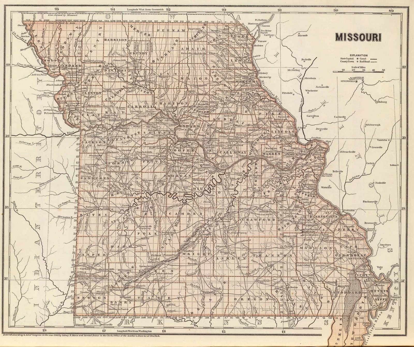
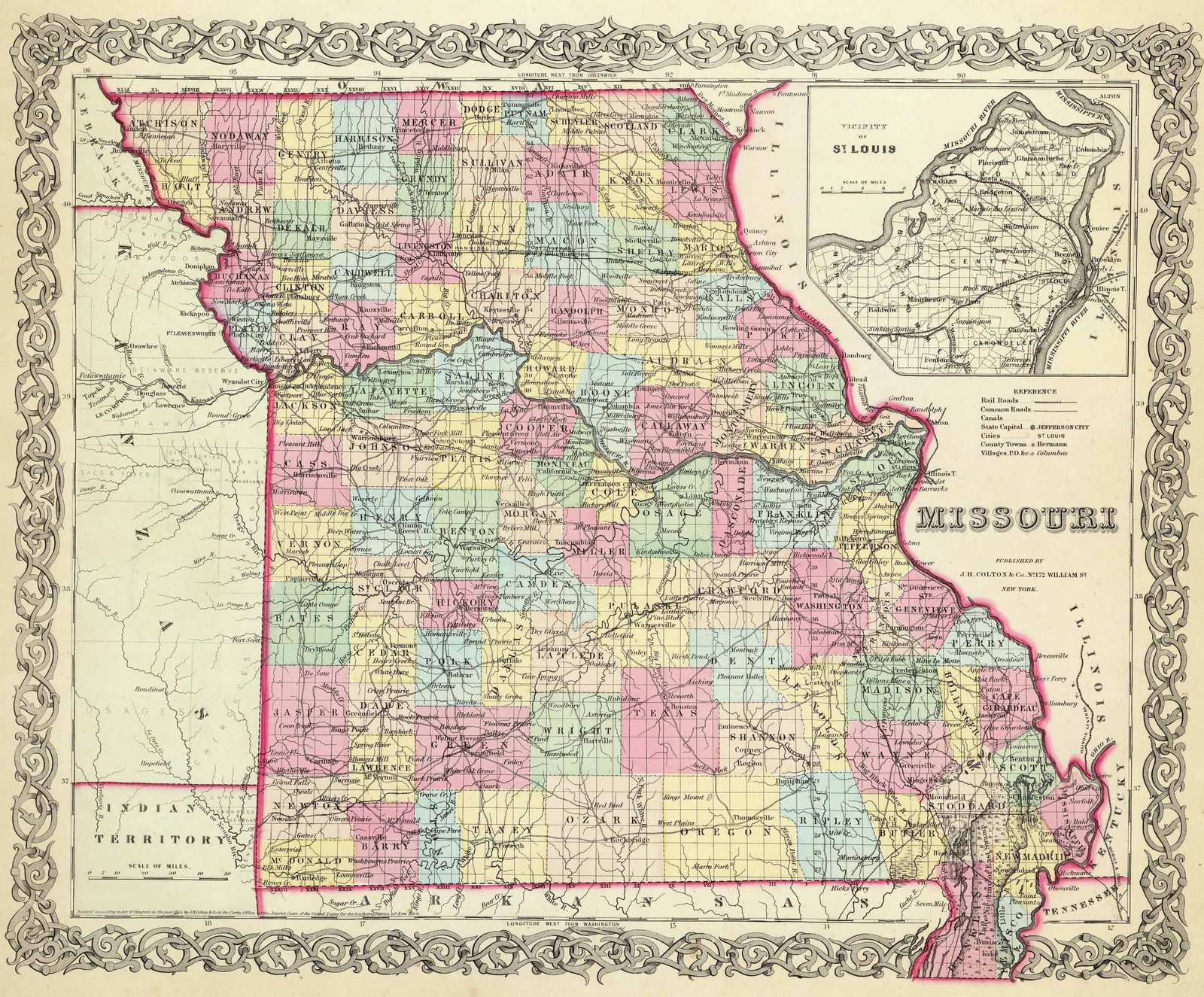
Old Historical Atlas Maps of Missouri
This Historical Missouri Map Collection are from original copies. Most historical maps of Missouri were published in atlases and spans over 000 years of growth for the state.
Some Missouri maps years have cities, railroads, P.O. locations, township outlines, and other features useful to the Missouri researcher.


Map of Missouri County Formations 1804-1889
This Interactive Map of Missouri Counties show the historical boundaries, names, organization, and attachments of every county, extinct county and unsuccessful county proposal from the creation of the Missouri territory in 1804 to 1889.
Missouri County Maps of Road and Highway’s
The Missouri Department of Transportation has prepared a series of county road maps online. These maps contain more detailed information about man-made features than the geological survey maps.
In addition to roads and boundaries, these maps include rural communities, churches, and cemeteries. Below are printable maps of Missouri’s 114 counties. These Missouri maps are Free to downloade are in PDF format.
External Missouri Map Resources
- Old Historical Maps of Missouri (alabamamaps.ua.edu)
- Missouri Maps, Atlases & Gazetteers (ancestry.com)
- U.S., Indexed County Land Ownership Maps, 1860-1918 (ancestry.com)
- Library of Congress Missouri Map Collections (loc.gov)
- Old Maps of Missouri (old-maps.com)
- Missouri Antique Maps and Historical Atlases (historicmapworks.com)
- Historical Missouri State Maps (mapsofthepast.com)
- Antique Maps of Missouri (raremaps.com)
- Missouri Map Books (amazon.com)