
| MI State Facts |
|---|

|
| Territory: Jan 1, 1805 |
| Statehood: Jan 26, 1837 |
| Counties: 83 |
| Borders: WI, OH, IN and MN |

| MI Resources |
|---|
| MI Land Ownership Maps |
| MI Maps & Atlases |
| MI Birth, Marriage & Deaths |
| MI Military Databases |
| MI Record Collections |
| MI Historical Newspapers |
| Create a Free Family Tree |
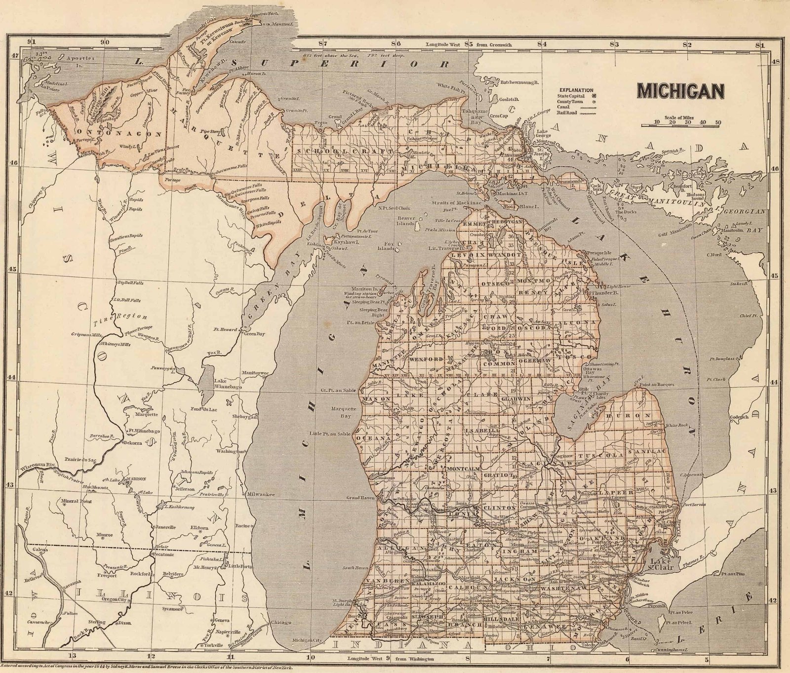
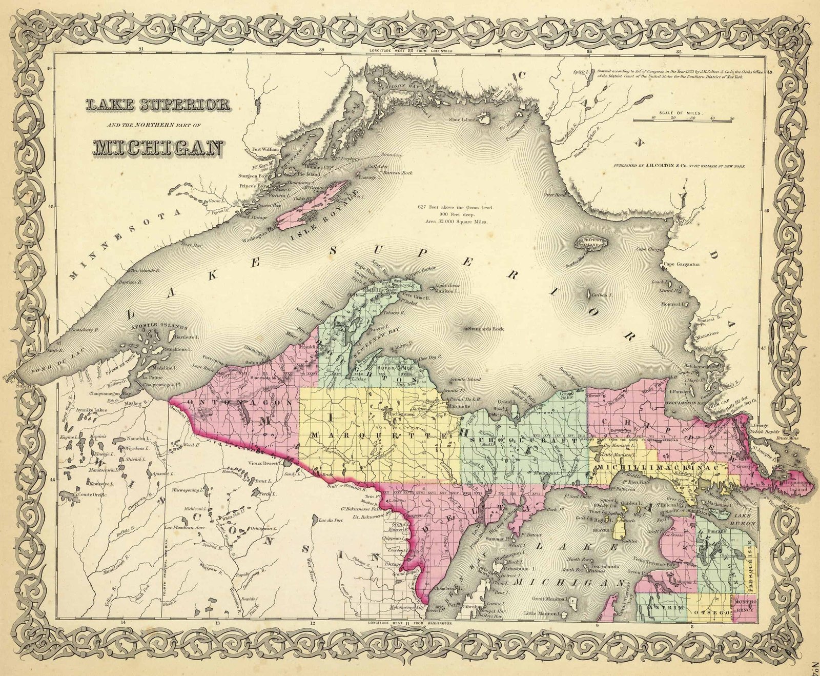
Maps of Michigan are a great resource to help learn about a place at a particular point in time. Old Michigan maps are effective sources of geographical information and useful for historical, genealogical and territorial research.
Our collection of Michigan maps includes many different historic and modern types of maps. The maps date from the 18th century to the present and include:

- Michigan Township maps, including maps showing the progress of the original government surveys
- Michigan Road, Highway and railroad maps
- Michigan Maps showing the state’s geological features
- Michigan timeline of county boundaries changes
- Michigan Military maps
- Michigan Maps of specific towns, counties, islands, harbors, and bodies of water
- Colonial era maps of Michigan
- Bird’s eye views of Michigan cities and towns
Historical Maps of Michigan are a great resource to help learn about a place at a particular point in time. Michigan Maps are vital historical evidence but must be interpreted cautiously and carefully.
The first map of Michigan that listed landownership was the John Farmer 1855 Wayne County plat map. However, many more land ownership maps were published in 1876 for Michigan’s centennial.
The Burton Historical Collection and the Library of Michigan each have large Michigan map collections on hand. A 14-volume set called “Checklist of Printed Maps of the Middle West to 1900” is an excellent resource for information on plat books and maps in Michigan, as well as 10 other states.
The 1868 Lansing Sanborn map is the earliest Michigan Sanborn map.
Old Historical Atlas Maps of Michigan
This Historical Michigan Map Collection are from original copies. Most historical maps of Michigan were published in atlases and spans over 200 years of growth for the state.
Some Michigan maps years have cities, railroads, P.O. locations, township outlines, and other features useful to the Michigan researcher.


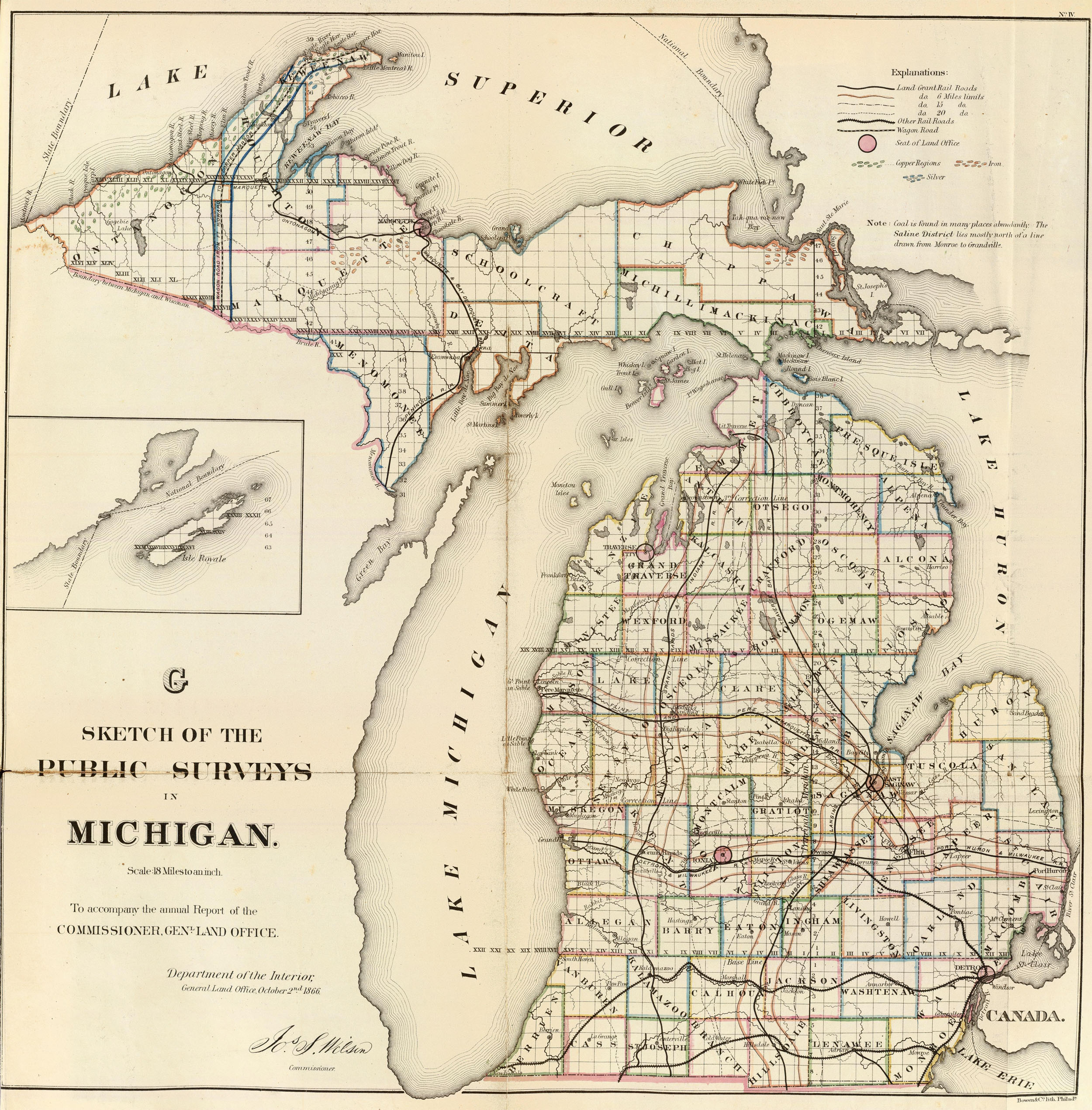


Map of Michigan County Formations 1790-1897
This Interactive Map of Michigan Counties show the historical boundaries, names, organization, and attachments of every county, extinct county and unsuccessful county proposal from the creation of the Michigan territory in 1790 to 1897.
Michigan County Maps of Road and Highway’s
The Michigan D.O.T. Highway Department has prepared a series of 2015 county road maps free online. These maps contain more detailed information about man-made features than the geological survey maps.
In addition to roads and boundaries, these maps include rural communities, churches, and cemeteries. These Michigan maps are Free to downloade are in PDF format.
External Michigan Map Resources
- Old Historical Maps of Michigan (alabamamaps.ua.edu)
- Michigan Maps, Atlases & Gazetteers (ancestry.com)
- U.S., Indexed County Land Ownership Maps, 1860-1918 (ancestry.com)
- Library of Congress Michigan Map Collections (loc.gov)
- Old Maps of Michigan (old-maps.com)
- Michigan Antique Maps and Historical Atlases (historicmapworks.com)
- Historical Michigan State Maps (mapsofthepast.com)
- Antique Maps of Michigan (raremaps.com)
- Michigan Map Books (amazon.com)