
| MD State Facts |
|---|

|
| Colony: 1632 |
| Statehood: Apr 28, 1788 |
| Counties: 23 |
| Borders: DE, MD, VA, WV and DC |

| MD Resources |
|---|
| MD Land Ownership Maps |
| MD Maps & Atlases |
| MD Birth, Marriage & Deaths |
| MD Military Databases |
| MD Record Collections |
| MD Historical Newspapers |
| Create a Free Family Tree |
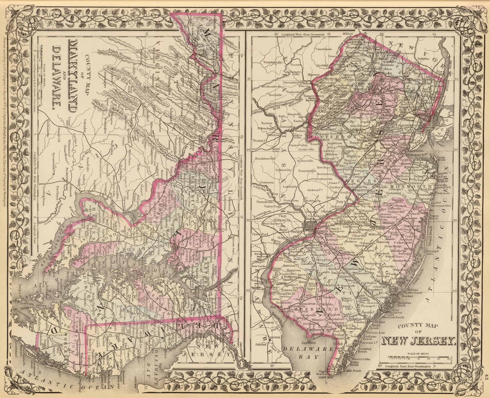
Maps of Maryland are a great resource to help learn about a place at a particular point in time. Old Maryland maps are effective sources of geographical information and useful for historical, genealogical and territorial research.
Our collection of Maryland maps includes many different historic and modern types of maps. The maps date from the 17th century to the present and include:

- Maryland Township maps, including maps showing the progress of the original government surveys
- Maryland Road, Highway and railroad maps
- Maryland Maps showing the state’s geological features
- Maryland Nautical charts
- Maryland timeline of county boundaries changes
- Maryland Military maps
- Maryland Maps of specific towns, counties, islands, harbors, and bodies of water
- Colonial era maps of Maryland
- Bird’s eye views of Maryland cities and towns
Historical Maps of Maryland are a great resource to help learn about a place at a particular point in time. Maryland Maps are vital historical evidence but must be interpreted cautiously and carefully.
Maryland Maps can be very useful in conducting research, especially in light of the now extinct communities. Also, because old Maryland maps were usually commissioned by the county seat, they often display information about the county, including town names.
The Maryland State Archives also holds a large collection of plats, atlases, and maps for the state. Many of those maps have tract and owner indexes available as well.
The Maryland Historical Society has a large collection of maps on file as well. Most counties also have genealogical and historical societies and collections that include useful county maps, some of which have been published.
Old Historical Atlas Maps of Maryland
This Historical Maryland Map Collection are from original copies. Most historical maps of Maryland were published in atlases and spans over 350 years of growth for the state.
Some Maryland maps years have cities, railroads, P.O. locations, township outlines, and other features useful to the Maryland researcher.


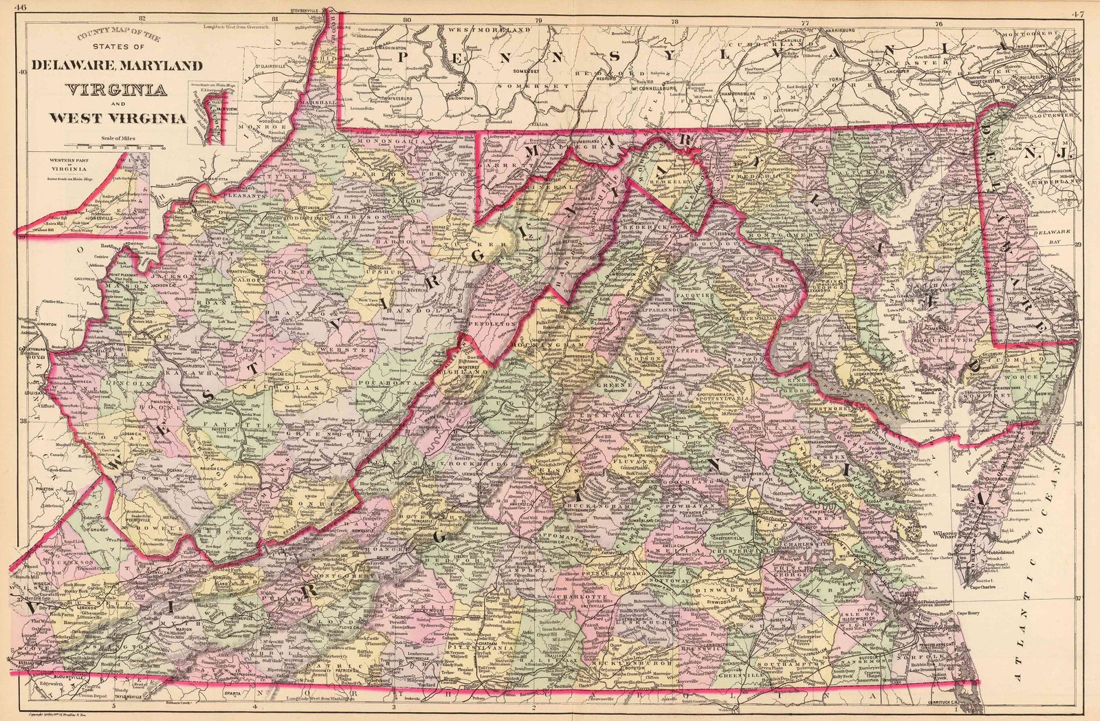
Map of Maryland County Formations 1637-1997
This Interactive Map of Maryland Counties show the historical boundaries, names, organization, and attachments of every county, extinct county and unsuccessful county proposal from the creation of the Maryland territory in 1637 to 1997.
Maryland County Maps of Road and Highway’s
The Maryland D.O.T. Highway Department has prepared a series of 2016 county road maps. These maps contain more detailed information about man-made features than the geological survey maps.
In addition to roads and boundaries, these maps include rural communities, churches, and cemeteries. These Maryland maps are Free to downloade are in PDF format.
Maryland Town Road Maps
The Town Maps on this page are for Maryland’s incorporated towns only. An incorporated town has its own government and defined municipal boundaries. Most commonly, towns are incorporated by acts of the Maryland General Assembly, although sometimes towns are incorporated by referendum.
These Maryland Town maps are Free to download are in PDF format.
External Maryland Map Resources
- Old Historical Maps of Maryland (alabamamaps.ua.edu)
- Maryland Maps, Atlases & Gazetteers (ancestry.com)
- U.S., Indexed County Land Ownership Maps, 1860-1918 (ancestry.com)
- Library of Congress Maryland Map Collections (loc.gov)
- Old Maps of Maryland (old-maps.com)
- Maryland Antique Maps and Historical Atlases (historicmapworks.com)
- Historical Maryland State Maps (mapsofthepast.com)
- Antique Maps of Maryland (raremaps.com)
- Maryland Map Books (amazon.com)