
| WI State Facts |
|---|

|
| Territory: Apr 20, 1836 |
| Statehood: May 29, 1848 |
| Counties: 72 |
| Borders: MN, MI, IA and IL |

| WI Resources |
|---|
| WI Land Ownership Maps |
| WI Maps & Atlases |
| WI Birth, Marriage & Deaths |
| WI Military Databases |
| WI Record Collections |
| WI Historical Newspapers |
| Create a Free Family Tree |
Our collection of Wisconsin maps includes many different historic and modern types of maps. Old maps of Wisconsin are effective sources of geographical information and useful for historical, genealogical and territorial research.
Copies of county plat books from about 1870 to 1900 can be found at the Wisconsin Historical Society. Some county plat maps can be photocopied, although microfilms of them are not available.

The University of Wisconsin’s Arthur Robinson Map Library, Science Hall has aerial photographs of Wisconsin in its collection. The Stoughton quadrangle was the subject of an 1889 topographical map, which was the first Wisconsin topographical map printed.
There are more than 200 maps of Wisconsin created from 1867 to the close of World War I. The Wisconsin Historical Society can point researchers to where they are held. They show excellent details about villages and towns in Wisconsin at the times when they were created.
The American Geographical and Statistical Society’s map collection can be found in Milwaukee. It is part of the University of Wisconsin’s Golda Meir Library’s collection.
The collection includes thousands of gazetteers, maps, photographs and bound books covering locations all over the world, including Wisconsin.
The Wisconsin Historical Society’s earliest Wisconsin Sanborn map on file is from the year of 1883. However, an earlier one was created in 1879 for LaCrosse and still exists today.
The Wisconsin territory initially included all of the present day states of Wisconsin, Minnesota, and Iowa , as well as parts of North Dakota and South Dakota.
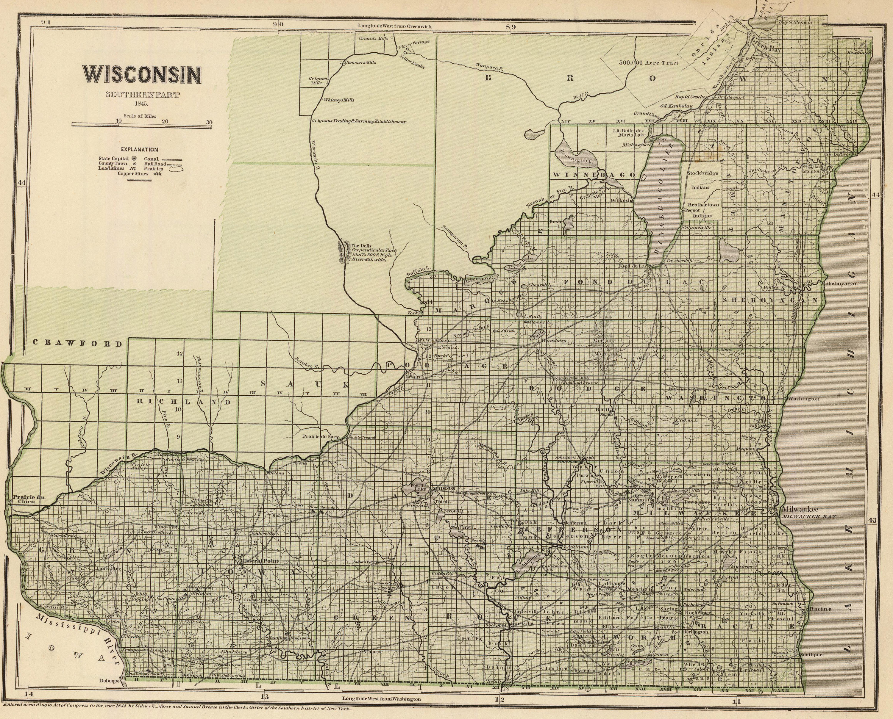
Old Historical Atlas Maps of Wisconsin
This Historical Wisconsin Map Collection are from original copies. Most historical maps of Wisconsin were published in atlases and spans over 175 years of growth for the state.
Some Wisconsin maps years have cities, railroads, P.O. locations, township outlines, and other features useful to the Wisconsin researcher.


Map of Wisconsin County Formations 1790-1961
This Interactive Map of Wisconsin Counties show the historical boundaries, names, organization, and attachments of every county, extinct county and unsuccessful county proposal from the creation of the Wisconsin territory in 1790 to 1961.
Wisconsin County Maps of Road and Highway’s
The Wisconsin D.O.T. Highway Department has prepared a series of county road maps. These maps contain more detailed information about man-made features than the geological survey maps.
In addition to roads and boundaries, these maps include rural communities, churches, and cemeteries. These Wisconsin maps are Free to downloade are in PDF format.
External Wisconsin Map Resources
- Old Historical Maps of Wisconsin (alabamamaps.ua.edu)
- Wisconsin Maps, Atlases & Gazetteers (ancestry.com)
- U.S., Indexed County Land Ownership Maps, 1860-1918 (ancestry.com)
- Library of Congress Wisconsin Map Collections (loc.gov)
- Wisconsin Antique Maps and Historical Atlases (historicmapworks.com)
- Old Maps of Wisconsin (old-maps.com)
- Wisconsin Antique Maps and Historical Atlases (historicmapworks.com)
- Historical Wisconsin State Maps (mapsofthepast.com)
- Antique Maps of Wisconsin (raremaps.com)
- Wisconsin Map Books (amazon.com)